Product Details:
| Place of Origin: | China |
|---|---|
| Brand Name: | ATC SENSING |
| Certification: | AS9100,ISO9001 ilac-MRA |
| Model Number: | DETA 100 Series |
Payment & Shipping Terms:
| Minimum Order Quantity: | 10 |
|---|---|
| Packaging Details: | Plastic fixture inside |
| Delivery Time: | 7-21 work days |
| Payment Terms: | T/T |
| Supply Ability: | 50K pcs / Month |
Micro Inertial Navigation System IMU / AHRS / INS / GNSS
Brief Introduction:
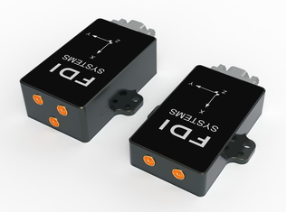
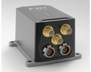
DETA100* series, a complete set of industrial-grade micro-inertial RTK satellite high-precision integrated navigation systems based on mems.
The features of this series are centimeter-level positioning, dual-antenna direction finding capabilities, redundant sensor technology, and a heading gyroscope with a zero-bias stability of 2°/h, for high-precision positioning and stable attitude and heading requirements.Application provides a complete solution.
The series includes single-antenna RTK, dual-antenna direction finding and support for 4G connection Chihiro location service function, a total of four models. The whole series adopts a sturdy metal casing and military-grade plugs, and the protection level is IP67.
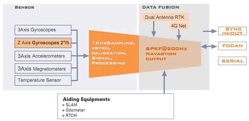
Equipped with the industry-leading self-adaptive SPKF nonlinear data fusion integrated navigation algorithm, after professional inertia calibration and temperature error compensation of -40℃~80℃, the self-adaptive installation parameter identification algorithm and powerful interface software are convenient to use immediately.
This series is especially suitable for applications such as ground autonomous vehicles, air vehicles, mobile robots, etc., where size and power consumption are tight.
Features:
■ Dual-frequency RTK centimeter-level positioning, dual-antenna direction finding, support network RTK
■ Redundant heading gyro technology for enhanced heading stability
■ Stable position angle output, 1cm position accuracy, heading angle 0.2˚ RMS, attitude 0.1˚ RMS
■ Heading gyro bias stability 2˚/hr
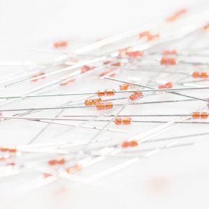
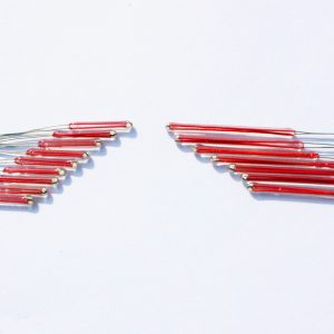
■ Bias, scale factor, orthogonality temperature factory calibration
■ Conical rowing compensation, adaptive SPKF
■ Serial port TTL / 232 & CAN interface
■ ITAR-free made in China
There are four products in the DETA100 series. Each product has a new, miniature, high-performance, factorycalibrated IMU core, magnetometer and one or two RTK receivers, using external access or self-built network.RTCM data stream input, all systems have the same inertial navigation system, and output high-precision PVT (position velocity attitude) navigation data.
DETA100R has a built-in single-antenna L1/L2 dual-band RTK receiver,which can access RTCM (differential correction) data through external devices to achieve centimeter-level positioning accuracy (RTK mode);
DETA100R4G is an improvement of R, which can connect to the network through built-in 4G devices The NTRIP base station (support Qianxun location) realizes the acquisition of RTCM data stream.
DETA100D has a built-in dual-antenna L1/L2 dual-frequency RTK receiver, which can measure the direction of the carrier through dual GNSS antennas, has a stable heading angle output, and is not affected by the complex electromagnetic environment interfering with the magnetometer;
DETA100D4G is an improvement of the D version, The RTCM data stream can be obtained by connecting the built-in 4G device to the network NTRIP base station (supporting Qianxun location).

Characteristics:
Each DETA100 series product features a powerful Sigma-Point Kalman Filter (SPKF), as well as a suite of highperformance algorithms, sensor sampling frequencies up to 1000Hz and compensation for cone and rowing motions, monitoring changes in ambient temperature in real time, The error of the sensor is estimated online, outliers and measurement anomalies can be identified and faults isolated, structured magnetic fields can be detected and compensated, and it has the ability to resist magnetic interference.
Our industry-leading algorithms provide high-accuracy position, velocity and attitude estimation along with compensated inertial measurements between 10 and 200 Hz for easy access to external vision, radar and other velocity, position, heading aids for integrated navigation.
